We groom the trails several times a week, and you can follow updated trail conditions here.
Here you can also click on the map to choose where you want to start your trip, add waypoints along the route, plan your entire tour, view elevation profiles, and download the full route to your phone for navigation in the terrain.
Trail Map for Beitostølen
Interactive trail map with up-to-date grooming status and trail conditions. On mobile, full-screen mode is recommended for the best experience.
Having trouble loading the map? Open the map here.
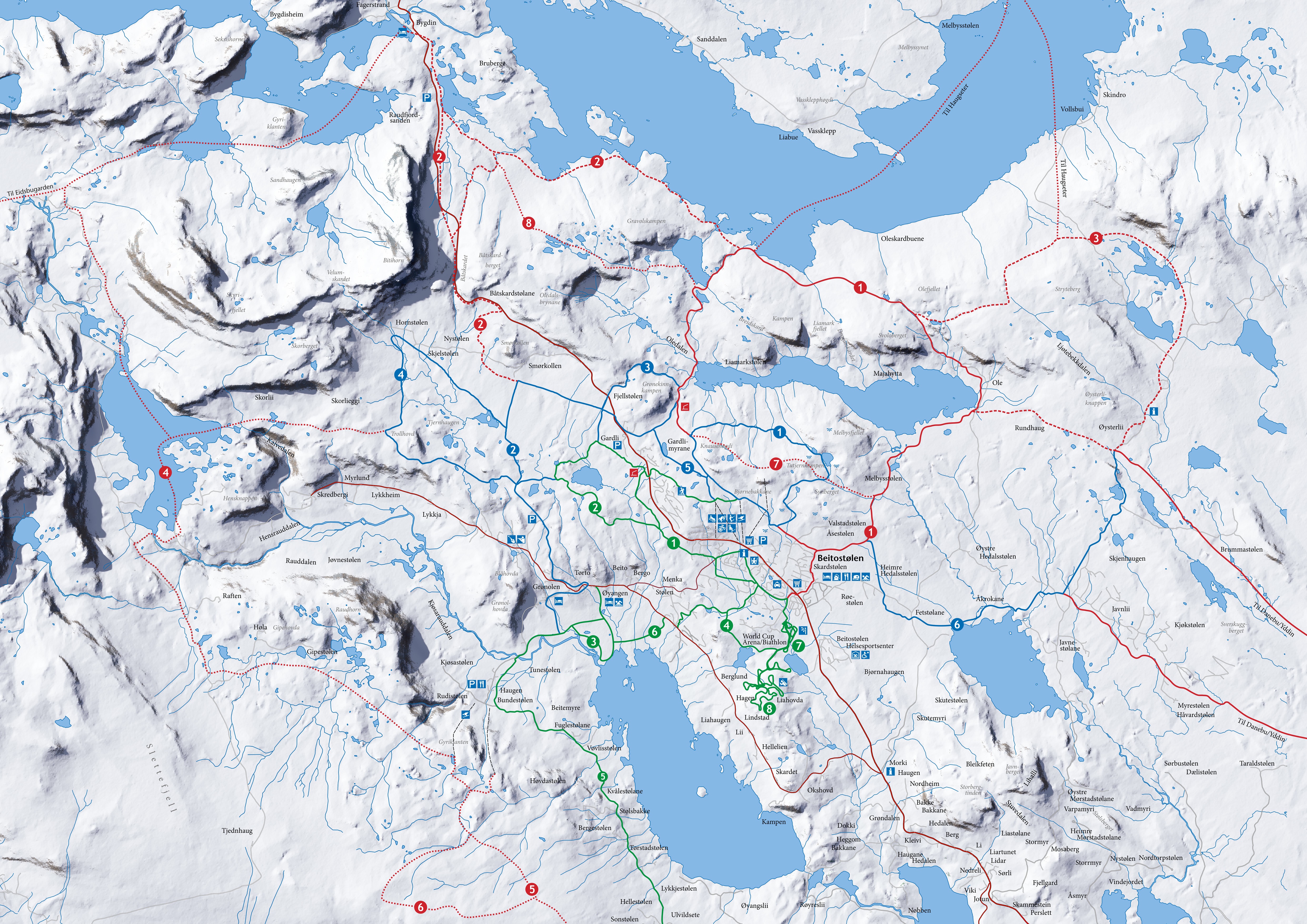
We also have a map showing trail names and color coding, where red and blue indicate high-mountain terrain, and green represents forested, more sheltered terrain.
Click on the map for a larger view.